With an altitude of 2702 meters, Mt. Hakusan or Mt. Haku (白山) is one of the top three mountains in Japan, along with Mt. Fuji (富士山) and Mt. Tate (立山) of the Tateyama Kurobe Alpine Route. With picturesque and magnificent scenery along the hiking trails, Mt. Hakusan is a popular hiking destination for any age group between July and October.
Table of Contents
- About Mt. Hakusan
- How to Get to Bettō Deai Trailhead
- What to Do at Ichinose
- Bettō Deai (別当出合) ⇒ Nakahanba (中飯場) ⇒ Jinnosuke Mountain Shelter (甚之助避難小屋), Approximate Time Required: 160 Minutes
- Jinnosuke Mountain Shelter (甚之助避難小屋) ⇒ Murodō (室堂), Approximate Time Required: 100 Minutes
- Murodō (室堂) ⇒ Gozengamine (御前峰), Approximate Time Required: 40 Minutes
- Gozengamine (御前峰) ⇒ Oike Meguri (お池巡り) ⇒ Ōnanjimine Peak (大汝峰) ⇒ Murodō (室堂), Approximate Time Required: 90 Minutes
- Guided Tours at the Top of Mt. Hakusan
- Staying Overnight at Hokusan Murodō
- Murodō (室堂) ⇒ Bettō Deai (別当出合), Approximate Time Required: 150 – 180 Minutes
- Things to Keep in Mind at Mt. Hakusan
- Alpine Flower and Autumn Foliage Seasons
- What to Wear When Hiking Mt. Hakusan
About Mt. Hakusan
Just like Mt. Tate, Mt. Hakusan is the collective name of the mountain range in the area, including the three main peaks, Gozengamine (御前峰), Ōnanjimine Peak (大汝峰), and Kengamine Peak (剣ヶ峰). The ground of Hakusan National Park (白山国立公園) is spread across Ishikawa, Fukui, Toyama, and Gifu Prefectures and has a couple of hiking courses for people to challenge themselves in each prefecture.
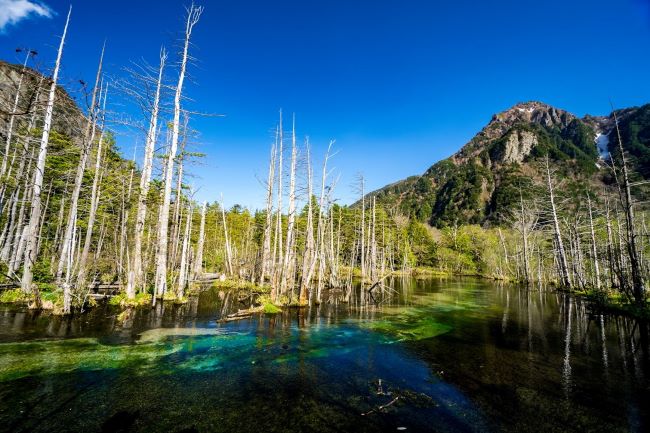
From the tallest peak – Gozengamine, you will get a panoramic view of the famous surrounding mountains such as Mt. Tate (立山), Mt. Hotaka (穂高岳), and Mt. Norikura (乗鞍岳). On your way to the top of the mountain, depending on which route you take, you might be able to take a brief rest and recharge at Midagahara (弥陀ヶ原) and view a field of gorgeous alpine flowers that seem to stretch indefinitely!
There are several mountain trails in Mt. Hakuzen with varying degrees of difficulty. For this article, we will focus on the most popular and least challenging course starting from Bettō Deai (別当出合) in Ishikawa Prefecture through Sabō Shindō (砂防新道) to the summit – Hakusan Murodō (白山室堂). The map to the right shows the entire journey.
As a return hike will take at least 7 hours without stopping, we highly recommend you spend a night at Hakusan Murodō. During the two-day trip, you will encounter precious flora and fauna that can only be seen in high mountains, the starry night sky that you can’t enjoy in the city anymore, and be enchanted by the sunrise scenery at the summit. On the way home, rejuvenate at one of the onsen pools at the foot of Mt. Hakusan, so you don’t wake up with muscle pain the following day (^_-)-☆.
- You can also refer to the official English map HERE.
- The main hiking season at Mt. Hakusan is between May and October.
- Between November and April, the mountain trail is covered by snow. While it is possible to hike Mt. Hakusan, it is not recommended unless you have rich experience in hiking in the snow.
How to Get to Bettō Deai Trailhead
By Public Transport from Kanazawa
On weekends and public holidays, bus services that connect you to Ichinose (市ノ瀬) depart in the early morning between JR Kanazawa Station (金沢駅) east exit’s bus stop no. 1. It takes around an hour and 45 minutes to get to Ichinose. From Ichinose, change for shuttle buses departing from the visitor center that will bring you to the trailhead at Bettō Deai (別当出合).
For the exact operating dates and the timetable, please refer to Hokutetsu’s Japanese website HERE as their English website, unfortunately, doesn’t have the information about the services heading to Mt. Hakusan. Note the link won’t work in the winter months.
The services are scheduled for an overnight hiking trip. This is why the returning services depart around lunchtime from Ichinose, allowing you some time for sightseeing in Kanazawa.
The connecting shuttle buses between Ichinose and Bettō Deai operate at a 20 minutes interval. Once you board the shuttle bus, it will take 15 to 20 minutes to get to Bettō Deai.
- Refer to HERE for the shuttle bus’s operating calendar and translate it to English by Google Chrome’s translation function at the right of the address bar.
- On days marked with a red circle, shuttle buses operate between Ichinose and Bettō Deai. Three services departing from and to JR Mattō Station (松任駅) will also run on the day.
- On the days that are marked “1日1往復運行日”, only one bus service operates between JR Mattō Station (松任駅) and Bettō Deai.
- On the days that are marked “下” with a blue circle, you can’t board the shuttle bus from Shiramine (白峰), which is a stop between Ichinose and JR Mattō Station (松任駅).
- If the calendar is still hard to interpret, contact us HERE, and we will get back to you.
The Transportation Cost to Ichinose and Bettō Deai
- A one-way trip from JR Kanazawa Station to Ichinose will cost 2,100 yen.
- From Ichinose to Bettō Deai, it will cost another 800 yen (400 yen for preschool children).
Driving to Bettō Deai
Please note that while there is a car park at Bettō Deai, private cars are forbidden to drive past Ichinose when the shuttle buses are operating. This means you will need to park your car at Ichinose Car Park, which has a capacity of 750 cars, and change for the shuttle bus.
The capacity might sound more than enough, but the car park may be full from early morning. So do try to get to Ichinose as early as possible if you are going to drive.
What to Do at Ichinose
Ichinose serves as one of the bases for Mt. Hakusan’s hikers. There is a visitor center for you to submit your hiking notification which is essential for a safe hiking trip. If you read Japanese and don’t need assistance filling in the form, you can submit your notification electronically HERE. Remember to top up your water bottle and drop by the public toilet here before you board the shuttle bus too.
- For those who are looking for accommodations, Hakusan Onsen Nagai Ryokan (白山温泉永井旅館) is just opposite the visitor center.
- You can also camp close by from June to October if you are bringing your own camping essentials.
- Please reserve by calling Minamiryū Sansō Lodge (南竜山荘) art +81-76-259-2022 beforehand.
- You can also refer to the official website HERE and translate it to English by Google Chrome for more details and photos of the facility.
Important: Ichinose is also the base for hikers heading to the mountains nearby. So don’t just follow other hikers thinking you will eventually reach the summit of Mt. Hakusan. They might be on their way to Shakashindō Trailhead (釈迦新道登山口) for Mt. Hakusan-Shaka (白山釈迦岳) or Bessandō Trailhead (別山道登山口) for Mt. Bessan (別山).
And the Hike Begins!
Bettō Deai (別当出合) ⇒ Nakahanba (中飯場) ⇒ Jinnosuke Mountain Shelter (甚之助避難小屋), Approximate Time Required: 160 Minutes
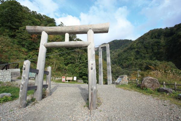
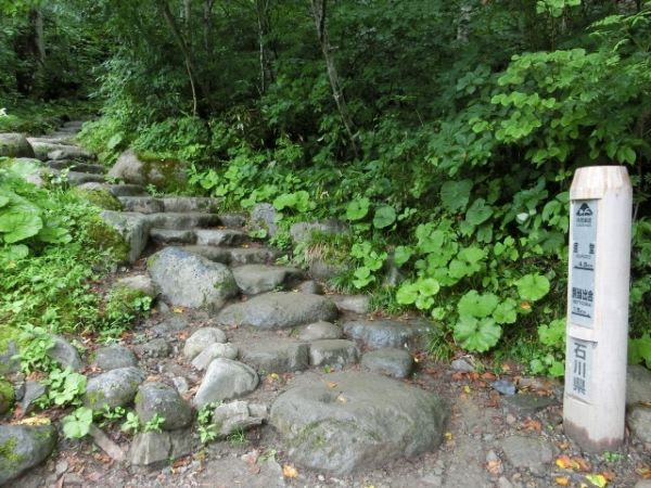
At the Bettō Deai Trailhead, you will see this wooden torii gate. The Bettō Deai mountain trail is actually the pilgrimage path to Shirayama Hime Shrine Oku-gu (白山比咩神社奥宮) at the top of the mountain.
From the suspension bridge beyond the torii gate, it should take you less than 60 minutes to get to the first resting area, Nakahanba, where you will find toilet facilities and a water supply.
From Nakahanba, it will be around another 140-minute hike to get to the Jinnosuke Mountain Shelter.
Throughout the journey, there are clear directional signs, big or small, with English underneath the Japanese (as portrayed by the sign in the photo). So there is no need to worry about getting lost.
Jinnosuke Mountain Shelter (甚之助避難小屋) ⇒ Murodō (室堂), Approximate Time Required: 100 Minutes
Jinnosuke Mountain Shelter is the second resting place along the trail. Many will take an extended break here. Not only do they need to recover their stamina, but also because the view from here is incredible!
Tip: If the tables around the shelter have all been taken, hike up a bit, and you should find another resting space with more tables (^_-)-☆.

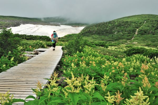
From Jinnosuke Mountain Shelter up to Murodō, the scenery is breathtaking. It is a course where you can fully enjoy the flora and fauna only seen in high mountains. Passing the Jinnosuke Mountain Shelter, your view will suddenly widen, with a high chance of seeing a sea of clouds.
Note that as you hike up, there will be an intersection. If the weather is good, we recommend hiking up via Echo Line (エコーライン) by detouring to Minamiryū-dō (南竜道) and hiking down through Sabō Shindō (砂防新道). To do this, around 20 minutes from Jinnosuke Mountain Shelter, choose the trail right at the intersection, then left when the road splits again. Going through the Echo Line means an extra 20-minute hike. But you get to see a field of alpine plants at Midagahara (弥陀ヶ原)!
You can, of course, choose to hike down by taking the Echo Line. But you never know what weather you will get on the way home. That is why you want to reach the area with the best view when the sky is clear!
Midagahara (弥陀ヶ原)
Just a short walk from Kuroboko-iwa Rock, you will finally enter Midagahara, a superb viewing area!

After you have had enough of the spectacular view of Midagahara, it is time to hike up the slope to Murodō.
The last bit of the trail to Murodō is probably the steepest and the most tiring. But, the magnificent scenery and food and/or snacks in the shop and restaurant at the Hakusan Murodō Visitor Centre should keep your motivation up!
Kuroboko-iwa Rock (黒ボコ岩)

The Kuroboko-iwa Rock is a rock created by an ancient volcanic eruption. Carried by the pyroclastic flow of the time, it is sitting at the tip of Midagahara (弥陀ヶ原).
The black rock is where the trail from Murodō splits into two trails – Sabō Shindō (砂防新道) and Kankō Shindō (観光新道). So when you see this black rock, you are just 30 minutes away from Murodō!
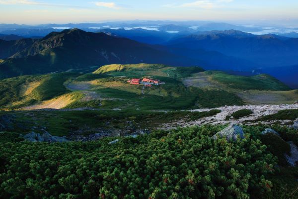
Hakusan Murodō (白山室堂)
The red-roofed visitor center is the symbol of Hakusan Murodō. Here, there are various essential facilities for hikers, including accommodation. It is also where you can get various information about hiking at Mt. Hakusan.
The shop and restaurant have snacks, instant food, and light meals that will help you recharge your energy. Even beer and other alcohol are sold here for those who want to be rewarded with a nice cold drink (^_-)-☆.

You can also send yourself a letter or postcard from the simplified post office here to mark your effort.
- Light meals are served from 11 am to 1 pm from the 30th of June to the 15th of October.
- The post office is open from mid-July to mid-August only.
If you have booked your accommodation for the night at Murodō, lighten yourself at your accommodation before you head to Gozengamine, the highest peak of Mt. Hakusan.
Important: The visitor center doesn’t have a bag storage facility for guests.
Murodō (室堂) ⇒ Gozengamine (御前峰), Approximate Time Required: 40 Minutes
Once you reach Murodō, our recommendation is not to spend too long at the visitor center if you are planning to head to Gozengamine that day. As the scenery may be cloudy later, heading up to the summit by 10 am will be the best.
Shirayama Hime Shrine Oku-gū (白山比咩神社奥宮)
Trekking beyond Murodō Visitor Centre, you will first see the prayer hall of Shirayama Hime Shrine Oku-gū (白山奥宮祈祷殿).
The real rear shrine, Oku-gū is at the highest peak – Gozengamine (御前峰).

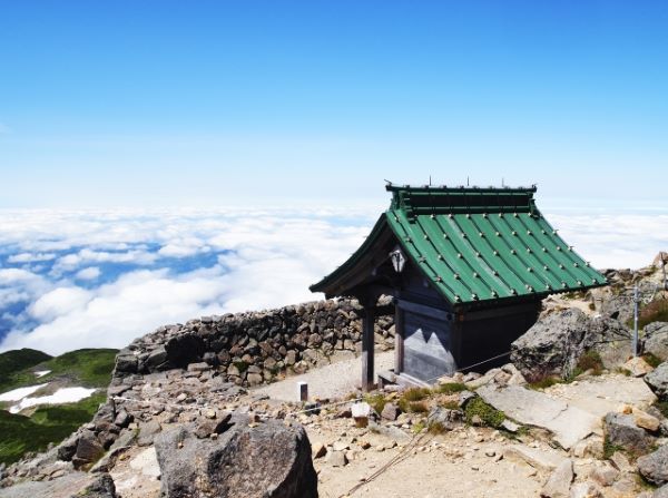
This rear shrine was erected by the monk – Taichō Shōnin (泰澄上人) in 717. Since then, numerous pilgrims have hiked up Mt. Hakusan for training.
Remember to pray here. The god that is enshrined here looks after Mt. Hakusan, after all!
Gozengamine (御前峰)
The scenery from 2,702 meters above the ground is simply stunning and magnificent. On a clear day, you can see the Murodō Visitor Centre with Mt. Bessan in the background. The red color of the visitor center contrasts starkly with the surrounding green (*´ω`).
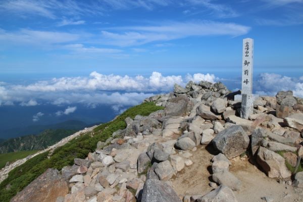
Assuming you started hiking to Gozengamine from Murodō, you should reach the summit right around lunchtime! So if you do have a packed lunch with you, enjoying it over the panorama view of the splendid surrounding scenery here will definitely be a once-in-a-lifetime experience (=゚ω゚)ノ.
Gozengamine (御前峰) ⇒ Oike Meguri (お池巡り) ⇒ Ōnanjimine Peak (大汝峰) ⇒ Murodō (室堂), Approximate Time Required: 90 Minutes
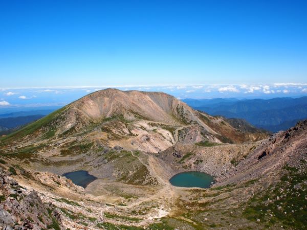
Once you have reached the summit of Gozengamine, you can extend your trip by touring around the 7 ponds (Oike Meguri in Japanese) at the top of the mountain and hiking to Ōnanjimine Peak. The Oike Meguri course is a loop that will bring you back to Murodō eventually.
Note that you will be climbing up and down some rocky trails that aren’t too well-maintained. So consider your physical stamina before you proceed.
From Gozengamine, if you look north, you will notice a few crater lakes. At the far back is the Ōnanjimine Peak with Aburagaike Pond (油ヶ池) at the left and Konyagaike Pond (紺屋ヶ池) at the right.
From the peak, descend towards the ponds by following the directory signs to Senjagaike Pond (千蛇ヶ池).
Midorigaike in the photo at the right is the biggest pond amongst the seven ponds at the top of Mt. Hakusan. Depending on the season you visit Mt. Hakusan, alpine plants might bloom along the trail.
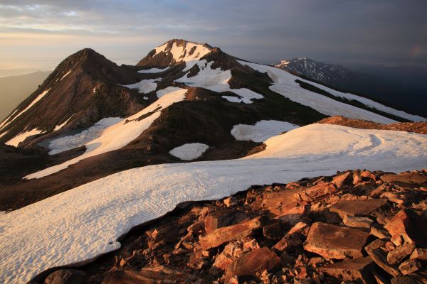
In spring, you will find the sides of the ponds are still covered by snow from winter. In autumn, the greeneries will be dyed with vibrant fall color, which is another stunning scenery to look forward to!
If you are lucky, you might bump into an alpine accentor and stoat as well (≧▽≦).

Please be really careful when you climb down the steep rocky section. Some stones aren’t stable and can fall when you step on them. So ensure the rock you are stepping down onto is firm before you put your whole body weight onto it. Once you reach the bottom, the trail becomes more apparent and a lot easier to walk on.
Ōnanjimine Peak
Passing the Midorigaike Pond, there is a trail leading to Ōnanjimine Peak. If you aren’t in a hurry, definitely hike up for the spectacular view of the mountain ranges close by from a different angle. The below photo to the right is the scenery of Mt. Hakusan that you will get at Ōnanjimine Peak!

Important: The area close to Midorigaike Pond (翠ヶ池) and Chinoike Pond (血ノ池) can become dangerous to get close to when the area is covered by fog-liked gas. You can easily get lost without being able to see the surrounding clearly. So please don’t risk your life for the sake of challenging yourself if the weather condition isn’t ideal.
Near Chinoike Pond, the promenade is split into two. The path on the left is a shortcut back to Murodō. Either route will go past the must-see Senjagaike Pond (千蛇ヶ池). So if you have had enough and are getting tired, choosing the shortcut won’t mean missing out on this iconic spot.
And why is Senjagaike Pond a must-see? It is for the snow/ice that never melts throughout the year. Even at the beginning of autumn, the snow from the last winter still covers part of the pond!
Guided Tours at the Top of Mt. Hakusan
- Below guided tours will take place from mid-July to mid-August for anyone to join. Note that it is only operated in Japanese.
- Summit and around the ponds tour: shortly after sunrise.
- Around Murodō-daira (室堂平) at 3 and 4 pm. Each session is around 40 minutes.
Staying Overnight at Hokusan Murodō
There are two accommodation facilities at Murodō, Hakusan Murodō – Lodge (白山室堂山荘) and Hakusan Raichō-sō Hut (白山雷鳥荘), both can only be booked with a phone call at +81-76-273-1001 from 9 am to 5 pm Japan time.
- Both accommodation facilities are not taking guests on the day. Please reserve at least 7 DAYS in advance.
- Especially with Hakusan Raichō-sō Hut (白山雷鳥荘), rooms can be fully booked quickly from late July to mid-August. So we recommend you reserve as early as possible. Reservation is open at 9 am from the 1st of April each year.
- If you need to cancel your booking, please let them know in advance. Note that cancellation charges will apply.
- If you are canceling due to bad weather conditions, please still let them know by midday of the day you booked.
You can check out the capacity calendar HERE for Raichō-sō Hut and HERE for Hakusan Murodō – Lodge before you call. The days that are marked with “x” have been fully booked.
Hakusan Murodō – Lodge
- Hakusan Murodō – Lodge is a dormitory-type accommodation that has a capacity of as many as 750 people. Below are things to note during your stay before you book.
- The lodge is taking guests from the 1st of May to the 15th of October.
- Bedding will be provided, but a sleeping bag liner is required due to COVID-19.
- No pillows will be provided.
- Toilet facilities are located outside of the lodge.
- Dinner and breakfasts can be provided upon request.
- Lights will be turned off at 8:30 pm in summer and 8 pm from September to the end of the season.
- There are no shower facilities at the lodge.
- For the accommodation cost, please refer to HERE and change the language to English at the top right of the web page.
- Please check with them at the time of booking if they can replace meat dishes with vegetables for you. You should be able to get extra rice upon request.
- If many guests are staying at Murodō, you will be given a 20 minutes dinner slot from 4:40 pm when you check-in
- 1,200 yen for a bento box that will be ready for you to collect after breakfast at reception
- If you want to replace your breakfast with a bento box (sushi), it will be ready for you to collect at the reception after dinner
Important: It is possible to change your meal request upon arrival. But no changes will be accepted after that.
Hakusan Raichō-sō Hut
- Hakusan Raichō-sō is a mountain lodge with 6 private rooms with a total capacity of 21 people. Below are things to note during your stay before you book.
- The hut is taking guests from the 25th of June to the 13th of October for the 2024 season.
- Bedding will be provided, but a sleeping bag liner is required due to COVID-19.
- Dinner and breakfasts can be provided upon request.
- Lights will be turned off at 8:30 pm in summer and 8 pm from September to the end of the season.
- Check-in is between 1 to 4 pm.
- Meals are provided at Hakusan Murodō – Lodge.
- For the accommodation cost, please refer to HERE and change the language to English at the top right of the web page.
- Please check with them at the time of booking if they can replace meat dishes with vegetables for you.
- You should be able to get extra rice upon request.
- Note it is possible to just book for a one-person stay.
- Please note a deposit of 10,000 yen per day is required to be transferred to the Raichō-sō’s bank account at least a week before your arrival. The bank account details can be found in the same link above.
- Please check with them when you call if you don’t hold a Japanese account.
Sunset and Star Gazing at Murodō
One of the benefits of staying overnight at Murodō is you get to enjoy the stunning sunset and nighttime sky full of stars!


Sunrise at Gozengamine
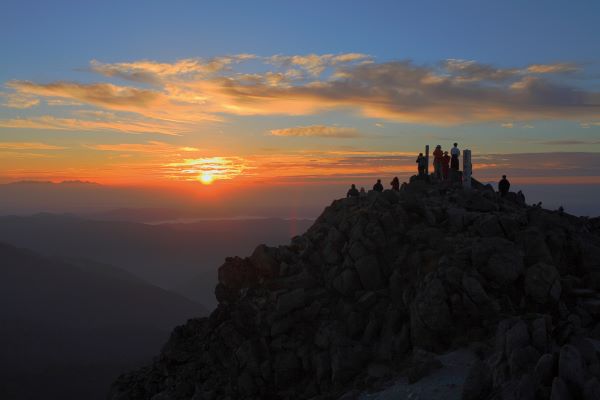
An hour before sunrise, you should be able to hear the sound of the Taiko drum (太鼓). Follow the sound and hike up to Gozengamine again for the beautiful sunrise!
Murodō (室堂) ⇒ Bettō Deai (別当出合), Approximate Time Required: 150 – 180 Minutes
After breakfast, when you are ready, let’s head back to Bettō Deai. At Kuroboko-iwa Rock (黒ボコ岩), you can decide whether you want to head back down through the Sabō Shindō (砂防新道) that you hiked up from the day before or hike down Kankō Shindō (観光新道), which is harder but offers better scenery.
The map to the right is for those who want to hike down via Kankō Shindō, which takes around 180 minutes, 30 minutes longer than Sabō Shindō (砂防新道).
Things to Keep in Mind at Mt. Hakusan
- The weather in the mountains can change easily. Hiking during bad weather is extremely dangerous. If it is not suitable for hiking, consider canceling the trip.
- Starting early and arriving early are the principles of mountain hiking. Make sure you arrive at your accommodation at least 2 hours before sunset. Hiking in the dark is never a smart move.
- A pair of comfortable and sturdy hiking shoes, rain gear, warm clothes, changing clothes, sunglasses, emergency medicine, and snacks with some degrees of calories and sufficient water is essential.
- The guideline for the replacement of hiking shoes is once every five years.
- A pair of holdable hiking poles will be really useful, especially when you climb down the mountain.
- Never try to bring anything that belongs to nature home.
- Stay on the mountain trail so you don’t get lost.
- No littering, and bring your garbage home. There are no garbage bins placed at Mt. Hakusan.
- Smoking is strictly prohibited.
- Bring a headlight if you are staying overnight at Murodō.
- If you are hiking on a weekday from September onwards, the restaurant at the top of the mountain may not be providing light meals during lunchtime.
- Meal tickets are sold between 11 am to 1 pm at Murodō.
Alpine Flower and Autumn Foliage Seasons
- Around Murodō
- Mid-July to August for alpine flowers
- Late September to early October for autumn foliage
- Around Minamiryū Sansō Lodge (南竜山荘)
- Mid-July to early September for alpine flowers
- From early to mid-October for the fall foliage
- Throughout the hiking trails
- from early to the end of October for the fall foliage

What to Wear When Hiking Mt. Hakusan
- Summer (July and August)
- Short sleeves with long sleeve light jacket in your bag
- Spring and Autumn (June, September, and October)
- A thick jacket is required as the temperature will only be around 5 to 15 degrees, with the temperature dropping to as low as 0 degrees at night and early morning
- In spring, a crampon is required as parts of the trails will still be covered by snow/ice
- It is also recommended that you wear two pairs of thick socks
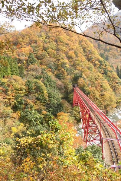
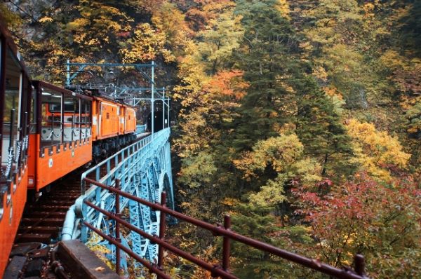
Discover Other Attractions in Hakusan City Nearby
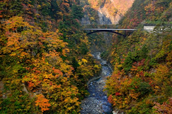
Hakusan City (白山市) is a city in Ishikawa Prefecture filled with breathtaking scenery. The city also features one of Japan’s best places for paragliding. Other attractions include Kaga Province’s largest shrine, a scenic gorge not known by many, one of the most popular cherry blossom spots in Ishikawa Prefecture, and more!
To find out more information about the city, please refer to our article on Hakusan City (=゚ω゚)ノ.