Nestled in the rugged heart of Northern Tohoku along the border of Iwate and Akita prefectures, Hachimantai is one of Japan’s most spectacular alpine destinations. Famous for its dramatic seasonal beauty, from the towering Spring Snow Corridor to brilliant autumn foliage, reaching this volcanic highland is an adventure in itself. Whether you are traveling by Tohoku Shinkansen bullet train or renting a car to navigate the iconic Hachimantai Aspite Line and lush Jukai Line, getting here requires a bit of planning. In this ultimate travel guide, we cover step-by-step route options, detailed travel times, public transit connections, and essential driving tips so you can explore Towada-Hachimantai National Park seamlessly.
How to Get to Hachimantai and the Seasonal Guide
- Reaching the Hachimantai Area: Gateway Routes
- Seasonal Road Closures & Crucial Travel Tips
- Recommended 1-Day Hachimantai Driving Itinerary
Reaching the Hachimantai Area: Gateway Routes
Because Hachimantai straddles the border of Iwate and Akita prefectures, travelers typically enter through two primary gateways: Morioka City (Iwate Side) to the east or Tazawako/Kazuno (Akita Side) to the west. Depending on whether you choose public transportation or a self-drive rental, here is how to navigate your arrival.
By Bullet Train (Tohoku Shinkansen) + Bus
Using Japan’s high-speed rail network is the most efficient option for non-drivers traveling from major hubs like Tokyo, Sendai (仙台), or Aomori.
Option A: The Iwate Gateway via Morioka Station (Recommended)
Morioka Station (盛岡駅) serves as the primary hub for accessing Hachimantai’s resort towns, hot springs, and summit trails. You can choose from year-round local bus services operated by Ugo Kōtsū (suspended from 2026) and the seasonal Hachimantai Shizen Sansaku Bus (Nature Explorer Bus, 八幡平自然散策バス) by Northern Iwate Transportation Inc. (岩手県北バス).
- Train: Board the JR Tohoku Shinkansen (Hayabusa or Yamabiko) from Tokyo Station to Morioka Station (~2 hrs 10 mins via Hayabusa).
- Hachimantai Shizen Sansaku Bus (operates from mid-April to late October): Head to Bus Stop No. 3 outside Morioka Station’s East Exit.
- To Hachimantai Onsen Town / Mountain Hotel: ~1 hour 30 minutes
- To Hachimantai Summit (Hachimantai Chōjō): ~1 hour 55 minutes
- Refer to Northern Iwate Transportation Inc. website for the bus timetable.
- Bonus Walking Tour: Passengers holding a Hachimantai Shizen Sansaku Bus ticket can join a complimentary Japanese-guided walking tour departing directly from the Hachimantai Summit Rest House around 11:05 AM daily from early June to mid-October.
- Ticketing & Passes: You can’t reserve bus tickets in advance.
- One-Way to Summit (行き券/帰り券): ¥1,700 (Adults) / ¥850 (Children).
- Bus fares are paid when getting off.
- 1-Day Local Area Free Pass (八幡平エリアフリー券): ¥1,600 (Adults) / ¥800 (Children)
- The area free pass covers local transit between attractions and the summit.
- Onsen Stay Combo Pass (行き・宿まで券/宿から・帰り券): ¥2,300 (Adults) / ¥1,150 (Children)
- The one-way pass allows a stopover at Hachimantai Onsen Town (八幡平温泉郷) or Matsukawa Onsen before returning to Morioka Station.
- It is the best pass for those who plan to explore the summit area and stay at Matsukawa Onsen or the Hachimantai Onsen resort area, or for those who wish to explore the summit area the day after their stay before heading to Morioka.
- Where to Buy the Passes:
- At JR Morioka Station, purchase at the Iwate Prefectural Transportation Information Center near East Exit Bus Stop No. 7.
- At the summit, buy at the Hachimantai Mountaintop Rest House.
- In the lower resort areas, tickets are available at select hotels (e.g., Hachimantai Rising Sun Hotel (八幡平ライジングサンホテル), Hachimantai Heights (八幡平ハイツ), Hachimantai Mountain Hotel (八幡平マウンテンホテル)) and the three onsen ryokan in Matsukawa Onsen (松川温泉).
- One-Way to Summit (行き券/帰り券): ¥1,700 (Adults) / ¥850 (Children).
- Refer to the Northern Iwate Transportation Inc. website for more information about Hachimantai Shizen Sansaku Bus.
Option B: The Akita Gateway via Tazawako Station (Currently Suspended)
If you are approaching from Akita Prefecture or exploring nearby areas like Lake Tazawa (田沢湖) or Nyuto Onsen (乳頭温泉郷):
Important: The bus service operates seasonally from mid-April to mid-October.
- Train: Board the JR Akita Shinkansen (Komachi) from Tokyo to Tazawako Station (~2 hrs 45 mins).
- Connecting Bus: From Tazawako Station, catch Ugo Kōtsū’s (羽後交通) Hachimantai Line (八幡平線) bound for Hachimantai Chōjō (八幡平頂上).
- Service Alert: Route coverage can vary by season, and operations may temporarily terminate early at Tamagawa Onsen (玉川温泉). Always verify the latest seasonal timetables before departing.
Alternatively, local JR train lines connect to Kazuno-Hanawa Station, where local buses serve the western entrance of the Aspite Line.
By Car (Self-Drive)
Renting a vehicle offers total flexibility across the Aspite and Jukai Lines. Car rental counters (Toyota, Nippon, Times) are situated directly outside Morioka Station, Tazawako Station, Akita Airport, and Iwate Hanamaki Airport.
| Starting Point | Driving Route | Distance | Estimated Time |
| Morioka Station | Tohoku Expressway (Morioka IC → Matsuo-Hachimantai IC) → Route 237 | ~45 km | 45–50 mins |
| Morioka Station | Highway Route 4 / Route 282 (Toll-Free) | ~42 km | 60–70 mins |
| Hanamaki Airport (HNA) | Tohoku Expressway (Hanamaki IC → Matsuo-Hachimantai IC) | ~75 km | 1 hr 10 mins |
| Akita Airport (AXT) | Akita Expressway → Tohoku Expressway (Matsuo-Hachimantai IC) | ~140 km | 2 hrs |
Pro Tip: Mountain passes are subject to weather shutdown and strict winter closures. Always confirm expressways and mountain roads are clear and open before setting out. If driving via expressway, set your GPS to Matsuo-Hachimantai Interchange (IC), located just 15 minutes from the Aspite Line gate.
Seasonal Road Closures & Crucial Travel Tips
Driving the Hachimantai mountain passes is one of Tohoku’s premier road trips, but high elevation brings dramatic weather variations. Because the routes cross volcanic terrain exceeding 1,500 meters, both the Aspite Line and Jukai Line are subject to strict seasonal schedule constraints and sudden closures.
Winter Closure Schedules (Full Shut-Down)
Both the Aspite Line and Jukai Line are completely closed to all vehicular traffic throughout the winter due to heavy snowfall and dangerous blizzard conditions.
| Route | Annual Reopening Date | Annual Winter Closure Date | Status |
| Hachimantai Aspite Line | Mid-to-Late April (Approx. April 15–20) | Early November (Approx. Nov 5–10) | Closed to all traffic ~5.5 months |
| Hachimantai Jukai Line | Late April (Usually a few days after Aspite) | Early November (Same as Aspite) | Closed to all traffic ~5.5 months |
The exact opening date varies each spring depending on snow removal progress. The official clearance event marks the unveiling of the famed Snow Corridor (Yuki-no-Otowake), where carved snow walls stand up to 8 meters high on either side of the road.

Frozen Road Warnings & Nighttime Gate Closures (夜間通行止め)
Even during the operational months (mid-April through early November), spring and autumn bring freezing temperature drops that create hazardous black ice.
1. Nighttime Closures (Spring & Late Autumn)
- When: From reopening in mid-April through mid-May, and again from mid-October until the winter shutdown in November.
- Gate Hours: Road gates automatically lock from 5:00 PM to 8:30 AM.
- Rule: Drivers must pass through the entry gates before 5:00 PM. Remaining at the summit after 5:00 PM risks getting locked inside the mountain pass overnight.
2. Temporary Weather Bans
- During late April and early May, sudden blizzards or freezing rain can trigger temporary daytime closures without prior notice.
- Always check the official Iwate Prefecture Road Information status or ask local tourist information centers in Morioka before heading up the mountain.
Recommended 1-Day Hachimantai Driving Itinerary
To experience the best of both worlds, the ideal 1-day driving route forms a scenic loop: ascend via the alpine Aspite Line, explore the summit highlights, and descend through the dense forests of the Jukai Line before relaxing in a traditional thermal bath.
Route Summary
- Total Distance: Approx. 115 km (71 miles)
- Total Driving Time: ~3 hours (excluding stops)
- Best Operating Window: Late April to late October (outside winter closure)
Step-by-Step Schedule
08:30 AM – Depart Morioka Station
Pick up your rental car at Morioka Station. Head north on the Tohoku Expressway toward the Matsuo-Hachimantai Interchange (IC).
- Driving Time: 45 minutes (~45 km)
09:30 AM – Begin the Aspite Line Ascent
Pass through the Matsuo-Hachimantai toll gate and enter the Hachimantai Aspite Line (Route 237). As the road weaves up the mountain, take advantage of roadside lookouts offering panoramic views of Mt. Iwate (known as the “Nambu Fuji”).
- Highlights:
- Spring (April–May): Driving between towering walls of the Snow Corridor.
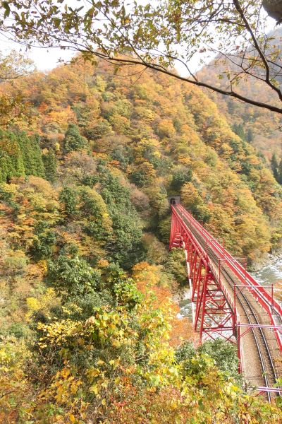
- Autumn (Sept–Oct): Sweeping views of yellow and orange mountain slope canopy.
- Driving Time: 40 minutes to the summit (~27 km)

10:15 AM – Hachimantai Summit & Dragon Eye Hike
Park at the Hachimantai Rest House (Parking fee: ~¥500). From here, take a well-maintained wooden boardwalk loop trail to the actual summit marker (1,613 meters) and surrounding volcanic ponds.
- Must-See Spot: Kagami-numa (Dragon Eye Pond). If visiting between late May and early June, witness the melting snow form a striking blue-and-white “eye” pattern in the crater.
- Time at Stop: 1 hour 30 minutes (Trail walk: ~45 mins round-trip)

11:45 AM – Lunch at Hachimantai Rest House
Enjoy lunch at the summit rest house dining hall while taking in views over the border into Akita Prefecture.
- Local Specialty Recommendations:
- Hachimantai Pork Curry or Inaniwa Udon (thick regional noodles).
- Iwanana (char fish) set meal or local milk soft-serve ice cream.
- Time at Stop: 60 minutes

1:00 PM – Descend via the Jukai Line
Head east from the summit parking area to transition directly onto the Hachimantai Jukai Line. Unlike the open alpine vistas of the Aspite Line, this 15 km road winds down through deep beech forests, volcanic valleys, and mountain streams.
- Key Stops along the Jukai Line:
- Yakehashiri Lava Flow: A spectacular 3-kilometer-long field of rugged black lava.
- Driving Time: 30 minutes (~15 km)

02:00 PM – Soak at Matsukawa Onsen
Near the base of the Jukai Line lies Matsukawa Onsen, a historic hot spring village nestled along the riverbank, famous for its rich, milky-white, sulfur-infused waters.
- Recommended Baths: Kyounso or Matsukawaso open-air baths (rotenburo).
- Day-Use Bath Fee: ~¥600 – ¥800 per person
- Time at Stop: 2 hours

04:00 PM – Return Drive to Morioka
Begin your return trip toward Morioka via Route 282 or the Tohoku Expressway.
- Driving Time: 50 minutes (~40 km)
Return your rental car at Morioka Station. Wrap up your day trip with a famous bowl of Morioka Reimen (chilled noodles) or Jajamen before catching your evening Shinkansen connection!
Start Your Journey from Morioka, Iwate’s Prefecture
Most travelers begin their Hachimantai journey from Morioka Station. If you are starting your road trip from Morioka, plan to spend some time exploring the city before heading into the mountains.
From historic sites and ironware shops to famous local noodle spots, check out our guide on what to do and see in Iwate’s capital city, Morioka to build the ultimate urban itinerary before your drive.