Discover the pristine wilderness of the Japanese Alps with our comprehensive guide to Kamikōchi (上高地), Japan’s premier mountain highland destination. Located within the Chūbu-Sangaku National Park in Nagano Prefecture, this breathtaking glacial valley is world-renowned for its crystal-clear Azusa River, the iconic Kappa Bridge, and soaring 3,000-meter peaks like Mt. Hotaka. Whether you are a casual traveler looking for a gentle stroll past the mystical Taishō Pond or an avid hiker preparing to summit the rugged North Alps, Kamikōchi offers an unparalleled escape into nature. Our guide covers everything from essential bus logistics and seasonal weather tips to the best walking trails and hidden photography spots in this strictly preserved “Special Natural Treasure.”
All You Need to Know About Kamikochi in Nagano Prefecture
- About Kamikōchi
- Explore Kamikōchi With a Guided Tour
- The Best Time to Visit Kamikōchi and Kamikōchi Open Time
- The 5 Rules to Follow in Kamikōchi
- The Scenic Spots in Kamikōchi
- What to Bring to Kamikōchi
- What to Wear at Kamikōchi and the Average Temperatures in Kamikōchi in Each Season
- How to Get to Kamikōchi
The Scenic Spots in Kamikōchi
Taishō Pond to Kappa Bridge Trekking Course
- Taishō Pond (大正池)
- Tashiro Marsh (田代湿原) and Tashiro Pond (田代池)
- Tashiro Bridge (田代橋)
- Kamikōchi Onsen Hotel (上高地温泉ホテル)
- Kamikōchi Lemeiesta Hotel (上高地ルミエスタホテル)
- Weston Relief (ウエストン碑)
Kappa Bridge to the Myōjin Area Trekking Course
- Dakesawa Marsh (岳沢湿原)
- Hotaka Shrine (穂高神社), Myōjin Pond (明神池), and Myōjin Bridge (明神橋)
- Resort Konashi (森のリゾート小梨)
- Kamikochi camping site
Myōjin Area to Yokoo Area Trekking Course
Refer to HERE for the Kamikochi Japan map.
About Kamikōchi
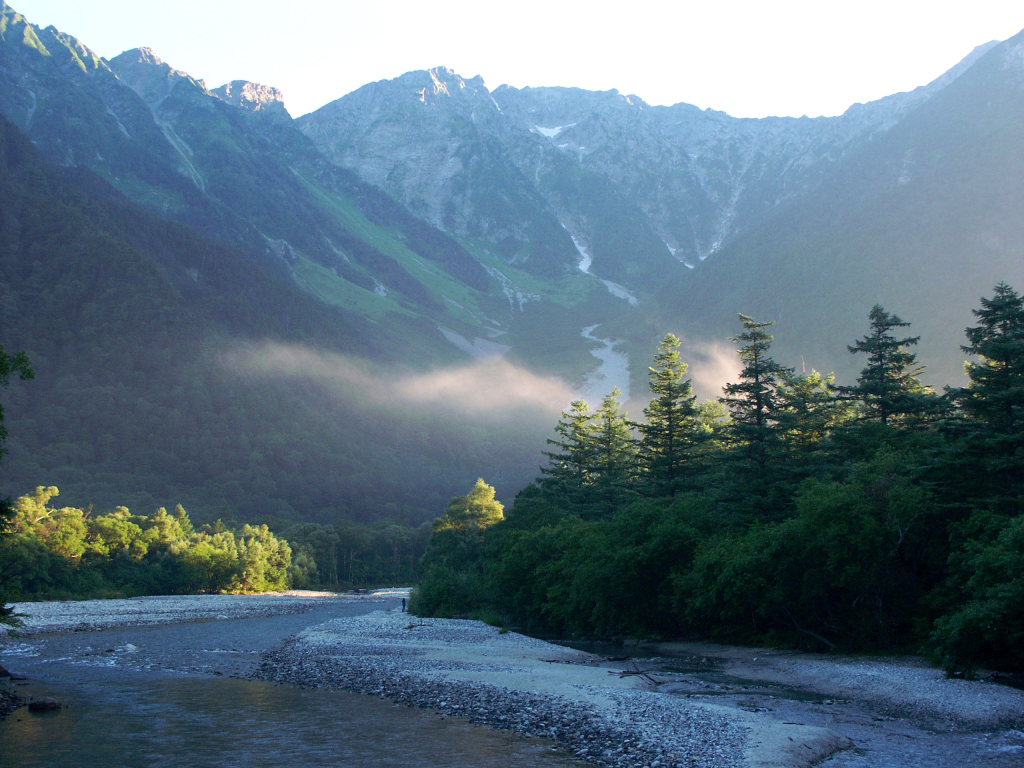
Kamikōchi in Japanese literally means “the ground that God descends upon”. It is the perfect name to describe how beautiful this area is. There is not a single day that Kamikochi looks the same, because nature changes with the passing seasons.
Although it is located 1,500 meters above ground, the trekking courses in Kamikochi are fairly flat and well-maintained. These tracks are up to 10 km long. There are rivers, ponds, forests, and wetlands along the tracks. All of these have disappeared from the lives of most people nowadays.
This is why over 1.5 million Japanese or foreign tourists choose Kamikochi when they are after a getaway from their busy urban life! And if you are an experienced hiker, basing at Kamikōchi to hike the spectacular Hotaka mountain range can be a great choice as well (=゚ω゚)ノ.
Explore Kamikōchi With a Guided Tour
If you prefer a guide to introduce you to the charms of Kamikochi, how about joining one of the following tours?
- Japan Alps Kamikochi Day Hike with Government-Licensed Guide
- 2D1N Kamikochi & Tateyama Kurobe Alpine Route Tour from Tokyo
- Kamikochi & Matsumoto Castle One-Day Tour from Nagano/Matsumoto
- Kamikochi Day Tour from Nagoya
Other Guided Options Include:
- Multilingual Mountain Guides
- They have a Kamikochi Nature Tour. You can choose from a 2-hour, 4-hour, or full-day option, depending on your preference.
- Please refer to HERE for further details.
- NIGN (Nagano Interpreter / Guide Network)
- Customized private tours with an English-speaking guide.
- The fee varies according to your plan.
- Please email them at [email protected] for further details and a quotation.
- Karuizawa Guide Service (KGS)
- They have various tour plans for you to choose from. Although they don’t currently have one in Kamikochi, you can opt for the customized option.
- The fee varies according to your plan.
- Please refer to HERE for all available tour plans.
- For experienced hikers, you can consider joining the Norikura Kōgen& Kamikochi Tour.
- A 3-Day tour that will guide you through Mt. Norikura and Kamikochi.
- Please refer to HERE and use Google Chrome’s translation function, located to the right of the address bar, for further details.
How to Get to Kamikōchi From Tokyo, Takayama, Matsumoto, and Nagano
If you are planning a trip to Kamikochi, figuring out the best way to get there is the first step. Since private cars are restricted year-round, you must rely on public transport. By taking a bus, you can easily get to Kamikochi from various parts of the Chūbu region, Tokyo, Kyoto, and Osaka.
For more information, refer to our article on How to Get to Kamikochi!
The Best Time to Visit Kamikōchi
Kamikochi is open to the public from late April to mid-November each year. Because the temperature is still chilly even in mid-summer (August in Kamikochi has a similar temperature to May or June in Tokyo), there is no standout tourist season.
| Season | Peak View | Temperature | Crowds |
| Spring | Snow-capped peaks & fresh green buds | Chilly (5°C – 15°C) | Moderate |
| Summer | Lush greenery & alpine flowers | Mild (15°C – 25°C) | High |
| Autumn | Golden larch trees & clear blue skies | Cold (0°C – 12°C) | Very High |
Kamikōchi is completely closed in winter. From mid-November to mid-April, the hotels, shops, and bus lines shut down entirely.
Kamikochi in Spring (Mid-April to June): Snow-Capped Majesty
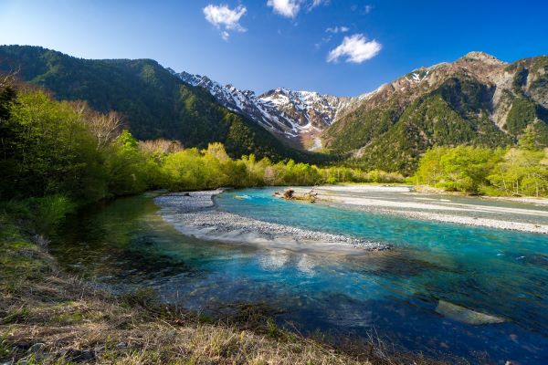
If you want to see the “classic” postcard view of the Hotaka Mountain Range, spring is unbeatable.
- The Look: The peaks are still heavily covered in deep white snow, creating a sharp, brilliant contrast against the bright blue sky and the turquoise Azusa River.
- The Trail: In late April and early May, you may still find patches of snow on the shaded promenade in the forest, but the trail by the river is usually clear.
- Highlight: The “Shin-ryoku” (fresh greenery) begins in late May, when the larch and birch trees explode into a vibrant, neon green.
From late May to mid-June, the number of tourists is usually lower than in other months. It is probably the best time to enjoy Kamikochi, albeit it is also the rainy season. However, be aware that the weather is still cold, with temperatures ranging from 6 to 10 degrees in the early morning and at night, to 12 to 17 degrees during the day.
Kamikochi in Summer (July to August): An Alpine Escape
While the rest of Japan swelters in humidity, Kamikōchi remains a cool sanctuary, with temperatures rarely exceeding 25°C. If you plan to camp in Kamikochi, visiting during the warmer months of July and August is probably best.
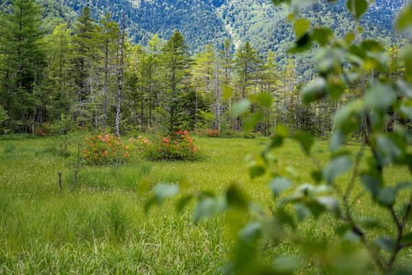
- The Look: The valley is lush, deep green, and full of life. Alpine flowers bloom along the edges of Tashiro Marsh.
- The Trail: This is the peak hiking season. Expect the trails to be busier, especially during the “Mountain Day” public holiday in August.
- Highlight: The water levels in Taishō Pond are often high, and the morning mist is most frequent during these humid summer months.

On August 11 of each year, the Shikatayama Festival (四方山祭り) is held in Kamikochi. You will find it particularly interesting if you love to stroll around craft markets (^_-)-☆.
Kamikochi in Autumn (October to November): The Golden Season
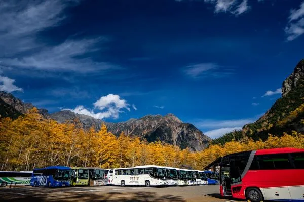
Autumn is arguably the most popular time for photographers to hike from Taishō Pond to Kappa Bridge. Fall colours will start replacing the vibrant green of summer in October. The autumn foliage is best seen from mid to late October. Depends on when the first snow comes, you might also see the Japanese Alps covered in snow when you visit Kamikochi in November.
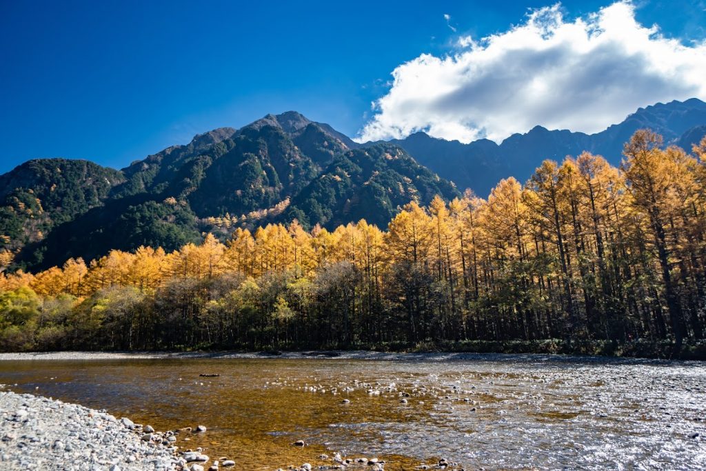
- The Look: The Karamatsu (Japanese Larch) trees turn a brilliant, shimmering gold. Unlike the deep reds of Kyoto, Kamikōchi’s autumn is defined by golden yellows and burnt oranges.
- The Trail: The air is crisp and incredibly clear, making it the best time for sharp, long-distance photos of the mountains.
- Highlight: Peak colors usually hit between October 15th and October 30th. Be prepared for freezing morning temperatures, it is not uncommon to see frost on the boardwalks!
The 5 Rules to Follow in Kamikōchi
Before we move on to introduce this stunning place to you, please take note of the following five rules when you get there:
- Don’t pick any plants or try to capture any insects
- Don’t feed the wild animals here
- Take all your rubbish home
- Don’t bring your pets of different species to Kamikochi
- Don’t walk off the promenade
Following the above five rules will ensure that Kamikochi’s beauty is preserved for future generations.
Taishō Pond (大正池)
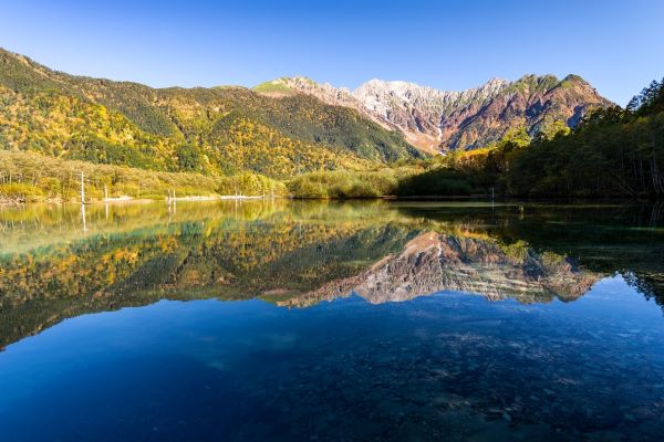
If you take a bus to Kamikochi, the Taishō Pond would be the first stop after the bus enters what the Japanese call the ground that God descends upon. Especially if you take the nighttime express bus from Tokyo, we highly recommend getting off the bus here instead of staying on until you reach the Kamikōchi Bus Terminal. Why? The pond is best known for its stunning sunrise scenery.
For more information about the stunning pond, refer to our Taishō Pond article!
The Most Relaxed Trekking Course: Taishō Pond to Kappa Bridge
Taishō Pond ⇒ Tashiro Marsh & Tashiro Pond ⇒ Tashiro Bridge ⇒ Kappa Bridge
The walking track between Taishō Pond (大正池) and Kappa Bridge (河童橋) is the easiest in Kamikochi. With the 3.5-kilometer track almost flat, even for those who don’t normally enjoy trekking, the one-hour course should still be a great experience, offering beautiful natural scenery. Starting at the mirror-like waters of Taishō-ike, you will wander through the golden wetlands of Tashiro Marsh and follow the crystal-clear Azusa River as it winds toward the iconic peaks of the Hotaka Mountain Range.
When we walked back to Taishō Pond from Kappa Bridge in the late afternoon, we even ran into a flock of wild monkeys! There were even little ones, and one was on the mother’s back!
So, refer to our Taishō Pond to Kappa Bridge: Kamikōchi’s Stunning Trail article to discover what to expect on the day. Whether you choose the panoramic Riverside Course or the tranquil Forest Course, our guide to the Taishō Pond walking trail provides everything you need to know about trekking times, photography spots, and how to navigate this must-see route to the historic Kappabashi.
Kappa Bridge (河童橋), Kamikōchi Bus Terminal (上高地バスターミナル), and the Nearby Facilities
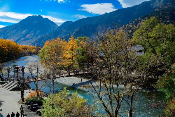
If you take the Left Bank Course, you will walk past the Kamikochi Bus Terminal before reaching the Kappa Bridge. On the other hand, the Right Bank Course will get you to this landmark in Kamikochi first. Regardless of the angle and part of the bridge, your photo is guaranteed to be stunning.
The area’s important facilities, including the Kamikochi Bus Terminal, are conveniently located near the bridge. This part of Kamikōchi serves as a transport hub, providing tourists with the necessary information to explore the area and rejuvenate.
For more information about what you can do around Kappa Bridge, including restaurants, refer to our article on The Guide to Kappa Bridge and the Nearby Facilities. You can even send a postcard to your family and friends from the post office here!
The Trekking Course from Kappa Bridge to the Mysterious Myōjin Area
Kappa Bridge ⇒ Dakesawa Marsh ⇒ Hotaka Shrine and Myōjin Pond ⇒ Myōjin Bridge ⇒ Resort Konashi ⇒ Kappa Bridge
This loop course starting from Kappa Bridge will take around 2 hours. While the scenery is extraordinary, there aren’t as many attraction spots as the trekking course between Taishō Pond and Kappa Bridge. This is perfect for all nature lovers who just want to indulge in Kamikōchi’s beauty!
Compared to the trekking course from Taishō Pond to Kappa Bridge, the course leading to Myōjin Area has a deeper slope. While it is not as hard as mountain climbing, you may get tired if you don’t normally exercise. We therefore highly recommend wearing proper trekking footwear to complete this course.
Tip: Make sure to use the bathroom before you begin this journey. The only toilet in this loop course is at Myōjin Shrine, an hour away from Kappa Bridge.
Dakesawa Marsh (岳沢湿原)
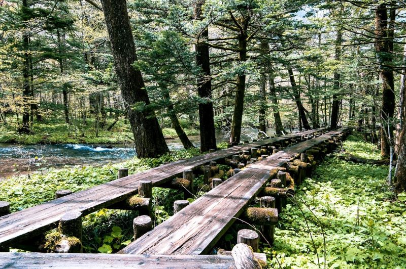
If you choose the Right Bank course (the track on the side of the Parklodge Kamikochi), after walking for 10 to 15 minutes in the coniferous forest from Kappa Bridge, you will reach Dakesawa Marsh.
The view of Roppyakusan Mountain from Dakesawa Marsh is just spectacular! Ensure you get onto the wooden deck because that is where you will get the best photo!
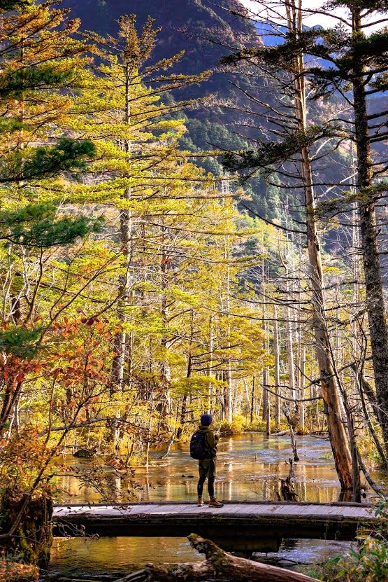
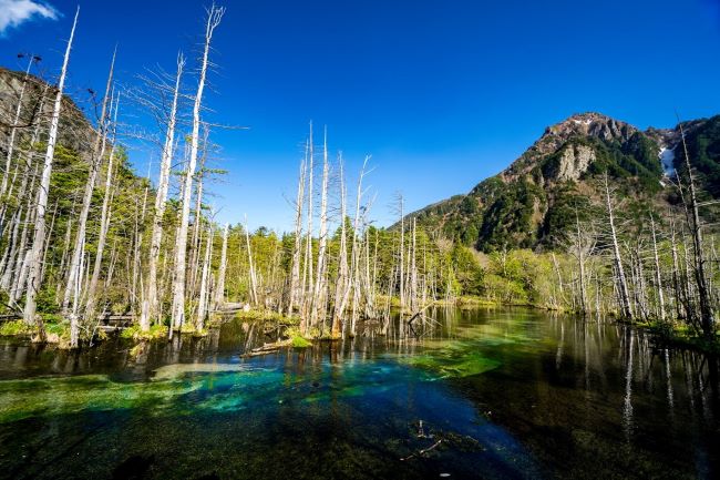
Different from the Tashiro Pond, the pond at Dakesawa Marsh is a sapphire color. Reflecting the bright blue sky and the greenery nearby, the view is just a painting itself!
The moss that grows on the tree is also beautiful (^_-)-☆.
Hotaka Shrine (穂高神社), Myōjin Pond (明神池), and Myōjin Bridge (明神橋)
Trekking further for another hour upstream of the Azusa River, you will reach the Myōjin Area. Here is the ground of God. Not sure if it is because this is where God lives, but the atmosphere around the area is distinctly different from Kappa Bridge.
Unless you plan to trek to the Yokoo area, the Myōjin Bridge is the return point of the loop course.

Refer to our article on the Myōjin Area for more information!
Resort Konashi (森のリゾート小梨)
Resort Konashi, also known as the Konashi-daira Campground (小梨平でキャンプ場), is the most affordable accommodation in Kamikochi. You can choose whether to spend a night in one of their tents or cabins.
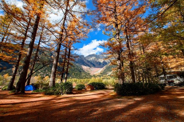
While you have to cook your own food at night, there is a shop selling ingredients for you to prepare your dinner. Come prepared with enough clothes and your wallet, and you will be able to survive a night in Kamikochi.
For further information, you can visit their Official Website and use your browser’s translation function to translate it into English.
Important: The temperature at Kamikochi rarely exceeds 23 degrees, even in summer (which is why it is the perfect spot to escape summer heatwaves). Especially at night, it can be freezing cold. Before booking one of their tent sites, ensure you are prepared and bring enough clothing to Kamikochi.
Resort Konashi’s Access Information
- To get to the Resort Konashi, take any bus service bound for Kamikochi and get off at the last stop – Kamikochi Bus Terminal (上高地バスターミナル).
- The Resort is just a 10-minute walk away from the bus stop.
- Please note that the area is closed to travellers from mid-November to late April.
Click HERE for more information about how to get to Kamikochi!
The Most Difficult Trekking Course in Kamikōchi: Myōjin Area to Yokoo Area
Myōjin Bridge ⇒ Yokoo Bridge
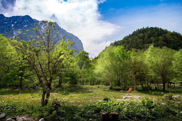
Although we said the “most difficult”, the track’s difficulty is still nowhere near mountain hiking. You will just travel through a gentle mountain road (with ups and downs).
And why do we recommend it? Because Yokoo (横尾) is a particularly beautiful place surrounded by silence. Along the way, you will be welcomed by rare plants and wild birds!
Yokoo is also the starting point for climbing the Northern Japanese Alps. So if you plan to do some real hiking, basing at Yokoo Area is definitely what you would want to do (^_-)-☆.
By the way, if you are looking for the starting point of the gorgeous Azusa River, Yokoo is the place that you need to visit!
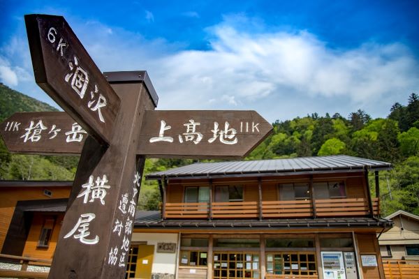
Yokoo Bridge (横尾大橋)
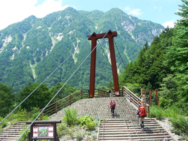
The view of the Hotaka mountain range from Yokoo Bridge is definitely more magnificent than Kappa Bridge because it towers over you! (≧▽≦).
Just to see this spectacular view, the 3-hour trek from Kappa Bridge will totally be worth it!
- To get to the Yokoo Bridge, take any bus services bound for Kamikōchi and get off at the last stop – Kamikōchi Bus Terminal (上高地バスターミナル)
- The Yokoo Bridge is a 3-hour walk from the bus stop.
- Please note that the area is closed to travellers from mid-November to late April.
Click HERE for more information about how to access Kamikochi!
What to Bring to Kamikōchi
| Item Category | What to Pack | Why? |
| Footwear | Light Hiking Shoes | While the paths are flat, they are gravelly and can be muddy after rain. Sneakers are okay, but hiking shoes offer better grip. |
| Clothing | The Layer System | Even in summer, mornings can be chilly (around 10°C). Pack a light windbreaker or a fleece. |
| Rain Gear | Compact Umbrella or Poncho | Mountain weather changes in minutes. A sudden afternoon shower is common. |
| Sun Protection | Hat, Sunglasses, and Sunscreen | The UV rays are much stronger at high altitudes, and the reflection off the water is bright. |
| Hydration | Reusable Water Bottle | Kamikōchi has several “water stations” with delicious, cold mountain spring water you can drink for free. |
| Safety | Bear Bell and Insect repellent | While bear sightings on the main Taishō Pond trail are rare, bells are the local standard for peace of mind. If you plan to visit Kamikochi in the warmer months, apply insect repellent to keep the bugs away. |
| “No-Trash” Policy | Plastic Bags | There are no trash cans along the trails or even at the bus terminal. Bring a small plastic bag to carry all their waste back to the city with you. |
What to Wear at Kamikōchi
Footwear:
- If you plan to explore only between Taishō Pond and Kappa Bridge, a pair of sneakers will suffice.
- However, if you plan to trek to the Myōjin Area or Yokoo Area, then a pair of trekking or hiking shoes would be a better choice.
Tip: Refer to our Top Three Best Walking Shoes for an Overseas Trip article for the best shoes to wear when you travel in Japan
Clothing in General:
- The temperature difference between morning and nighttime can be significant in the mountains, and sudden weather changes are also common. This is particularly true in Kamikochi. Therefore, we recommend clothes that can be easily taken off and put back on (such as windbreakers and hoodies). Innerwear that is sweat-absorbing and quick-drying will be handy too.
- Even in mid-summer, Kamikochi rarely has temperatures more than 23 degrees (with the lowest being below 10 degrees). To avoid bug bites and accidental injuries, wearing long sleeves and pants is always recommended.
- Also, wearing a hat will protect you from the occasional dazzling sunlight!
Clothing Depends on the Season:
- From April to mid-May and in October and November: Kamikochi may experience snowfall during these periods of the year. Normal winter clothes suitable for areas like Tokyo are recommended. Wearing a windproof jacket over the fleece or down jacket will keep you really warm!
- The average temperatures in Kamikochi in April and October are 7.4℃ and 12.7℃, respectively.
- From mid-May to the end of June and from mid-August to the end of September: Kamikochi may be frosty during early morning and nighttime. If you are arriving at Kamikochi early or staying overnight, remember to bring a jacket and a pair of gloves.
- Recommended clothing is a thin fleece, a windbreaker, comfortable long pants, a brimmed hat, and thin gloves.
- The average temperatures in Kamikochi in May, June, and September are 14.3℃, 17.1℃, and 17.3℃, respectively.
- From July to mid to late August: On a day with good weather, a T-shirt will suffice, but the temperature will drop in the morning and evening. On a day with bad weather, remember to bring a thin jacket with you.
- The average temperatures in Kamikochi in July and August are 21.2℃ and 21.4℃, respectively.
Tip: A cap on a rainy day is really handy. Even if you have a hoodie on, you can still walk comfortably without poor visibility!
| Item | Spring/Autumn (The Cold Peaks) | Summer (The Alpine Escape) |
| Outerwear | Insulated jacket or down vest. | Lightweight windbreaker or hoodie. |
| Base Layer | Thermal top (Heattech) and wool socks. | Breathable, moisture-wicking t-shirt. |
| Footwear | Waterproof hiking boots (paths can be icy/muddy). | Sturdy sneakers or trail running shoes. |
| Rain Gear | Mandatory. A sturdy poncho or rain suit. | Compact umbrella or light rain shell. |
| Accessories | Knit hat and gloves (especially for morning). | Wide-brimmed hat and polarized sunglasses. |
Combine Your Visit With Other Nearby Popular Destinations and Save on Transportation
If you are visiting Kamikochi and visit at least 2 of the following spots, the 4-Day Alps WIDE Free Passport might save you money! The ticket is valid for 4 consecutive days, allowing you ample time to sightsee in each of the destinations!
- Kanazawa
- Shirakawago
- Gokayama
- Takayama
- Matsumoto
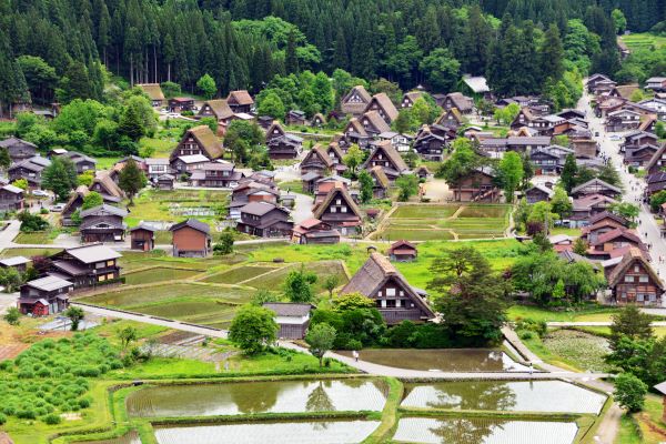
For more details about the ticket, please refer to our Chūbu region transportation article HERE (=゚ω゚)ノ.